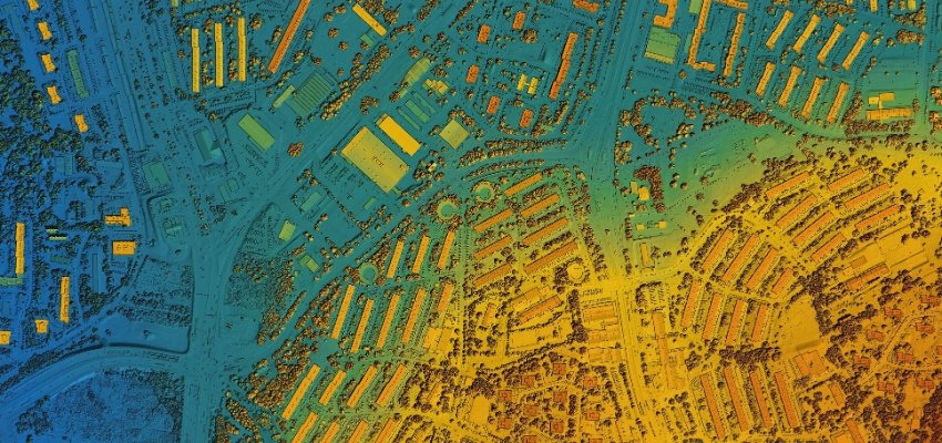
Service TypeSurveying Services Mapping and GIS Services Create detailed maps and manage spatial data for various applications. Digital Mapping: Produce high-resolution maps using satellite imagery, drones, or ground surveys.Applications include urban planning, navigation systems, and land use management. GIS (Geographic Information System) Analysis: Process and analyze spatial data for informed decision-making in urban planning, utilities, and environmental management. Data Visualization: Transform raw spatial data into interactive maps, 3D models, or other visual formats. Talk to Us Strategic Solutions Subject 01 02 03 Send Now